Featured Post

Tuesday, February 28, 2017

Juniper Springs

Dinner at Paul-HelensWhen we left Silver Lake we drove about 25 miles to Inverness, the home of our friends Helen & Paul Tempesta. Helen insists she loves to cook and made us a wonderful roast beef dinner, my favorite. It was nice to see them again and we camped in their yard.Our RV at Paul-Helens

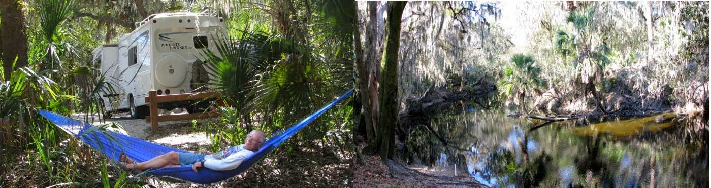
On Sunday we left for our favorite campground Juniper Springs. I looked up when we had been here before. We camped and canoed here with the kids. in 1969, 1973 & 1975. The spring does not look that different from 48 years ago.

                               1969 View                                        2017 View

Juniper Springs-1969

Juniper Springs-2017


A lot more people paddle the river now. The park rents canoes & kayaks and can provide a shuttle for private boaters. One way that works out well for us is they can do a reverse shuttle for only $10. You drop your boat off at the put-in and then drive to the small parking lot at the take-out, where they will bring your driver back to the launch. The parking lot is small and has only a few parking places that we could fit our RV into, so I did the early 8:30 AM shuttle and got a parking spot. Years ago, I used to do my own bike shuttle, but the narrow bike lane on the busy state highways is too scary for me now.

Juniper Launch SpotThe temperature was barely 50oF but warmed to the mid 80’s when we took out.

I thought Monday would not be that busy for this 7 mile beautiful paddle down the shallow winding river. A canoe & two kayaks launched before we did but there had to be at least two dozen boats getting ready to launch. We saw nobody all day until about 2 miles before the end when we caught up to the three boats scouting the big rapid on the run. There is a big rock in the middle of a narrow chute but we didn’t make our run look too good. We paddled a little too left of the rock and clipped a small tree branch which turned us around. Maybe next time we will go a little slower and try not to show off.

Juniper Run - 1

This by far was the prettiest run of all our paddling in FL this year. I guess this is why we keep coming back, even though there is no power, water, TV or cell reception in the park. Ocala National Forest is large and has many wilderness campsites in the back country. But we love Juniper Springs for the beautiful spring and river. They take reservations here but they are only needed on the weekend.

2017 FL Map5

Here is our planned route North to Ocean Pond and then to Stephen Foster Sate Park in the Okefenokee in Georgia.

After  we paddle there if the weather looks OK in Cleveland, we plan to head up through GA to Columbia, SC and follow I-77 home.

Tuesday, February 21, 2017

Silver Lake Again

Canoeing_Withlacoochee_w

2017 FL Map5 We just arrived at the Silver Lake campground complex and have again decided to stay in Cypress Glen Campground. We didn’t get the exact campsite that we wanted but we got the one next to it and it is only a few yards further from the canoe launch area.

As I told about this in older blogs there are several reasons to stop at the campground. It’s easy to get to, right off I-75. Not many people know about it, since it is a State Forest and not widely advertised and they don’t take reservations. It has 30/50 amp power & water at two of the 3 campgrounds. It is on a lake that is really a wide spot on the Withlacoochee South river. You can paddle up and down the river from here and if you want to just paddle downstream, you can arrange a shuttle at a canoe livery or just spot your vehicle at the take-out and bike, on the parallel bike trail, back to the camp to start your trip.

And for bicyclists, the camp is only 1 mile off the the 46 mile long Withlacoochee State Trail, one of the longest paved bike trails in FL.

We are starting to think about home and the route we may take North. Our plan is to stay here for five nights and then, on Saturday, go visit Helen & Paul who live just a few miles away in Inverness. We were going to visit them in December but it didn’t work out. We met them in Mexico where we all camped at Xpu-Ha in 2013-14.

We noticed that the campsites at Juniper Springs in Ocala National Forest are reserved on most weekends so we plan to arrive on Sunday morning when the weekenders leave.

We skipped the Okefenokee this year when heading south so we hope to paddle there as we head more north in early March. Our plan is to enjoy the back roads of Florida and Georgia and avoid the interstate highways as much as possible.

Sunday, February 12, 2017

Back at Lithia Springs for another week or so

Alafia RiverWe got here about noon on Wednesday. We were surprised to find that only a few campsites were available. But, luckily we got the same site that we were in last month. Which is right across the camp ground road from the river. When we left Estero it did not rain but we were happy that they got 3/4” rain last night before we got here. The river has been running on the low side all winter due to lack of rain in FL. I checked the USGS gauge and the river had already come up from 80 to 100 CFS, we hoped that by Thursday it would come up even more. Now we needed to find a way to get our canoe to the Alderman’s Ford  to launch on Thursday.

So I biked around the campground and found a couple with a canoe on their pickup truck. They are paddlers from NC and were planning on paddling the river on Friday but offered to drop us and our canoe off at the put-in on Thursday morning, if I would bring their truck back from the put-in to the take-out on Friday. Of course I jumped at the deal and luckily for us the level came up to 130 CFS.

Alafia River Take-Out

 Last year we paddled the river twice, both times near 300 CFS, which made the 9.5 mile run much faster. But todays level was high enough that we never touched a rock even running over the 6-7 shallow class I rapids.  With our rest stop at Duck Landing it took us just over 3 hours. The river dropped to 100 CFS for our new friends run on Friday and they said it was passable but in their light weight Kevlar canoe they would not have wanted to paddle it any lower.

Feral HogsIt was cool, low 70’s, but we still saw 3 gators, some feral hogs and a site we never saw before. A large Heron caught a big snake and when we went by he took off with the big snake dangling from his beak. I hope he shared it with his family.


FishHawkTrails9_thumb2

The other reason we like this campground is that there is access to the miles of concrete trails, shown in orange on the map, that go through all the natural areas of this huge housing development called Fish Hawk Ranch. Click for bigger picture.

The park has a bike/hike trail that runs near the river but it is for hardier souls.

We biked about 8 miles on Friday and about 10 miles on Sunday and went in two totally different areas. Not counting the sidewalks along the streets there has to be at least 25 miles of trails along the retention ponds and wild areas.

We were looking for a mailbox to mail our grandson Jeffery’s birthday card. No mail boxes or post office at all, we mailed it back at our campground.

Tuesday, February 7, 2017

Three Days at Koreshan State Park

Koreshan Boat-RampWe left Collier-Seminole State Park early Sunday morning. We did a lot of food shopping and headed to Koreshan State Park where I had reservations for three nights. Our plan was to get a site and have a nice rest and paddle on Monday. First of all some of these FL parks are goofy. Even though the site is empty, until it has been cleaned you can’t sign in. They said we could park at the picnic ground until 3 PM. It was not even noon yet. When we drove to the picnic parking we saw the boat launch which was not near our campsite, so we had a great idea, drop the canoe off, lock it up and see if our site was empty, it was…. but wait we can’t sign in until 3 PM. So we parked in our camp site and enjoyed our rest and signed up after 3 PM. Go figure. The rules are the same in all FL parks, but everywhere else they say, if it’s empty go get it.


Koreshan Estero PaddlingThere are some river access spots closer to our actual campsite but this worked out better for us since we wouldn’t have to roll our canoe over there and it was already off the RV and we could get our antenna up to watch the Super Bowl. Great game!!


So, early Monday morning we peddled our bikes to the boat ramp and locked our bikes up in place of the canoe. We got an early start and hoped we could paddle 4 miles down the river to Estero Bay and then possibly paddle 3/4 mi in the bay to Mound Key Island State Park.


It has been 25 years since we paddled this river, which I had remembered  was similar to the Blackwater River at Collier Seminole, wrong. Lots of Houses, docks, power boats and it is not a scenic trip. We did see a Manatee, Heron’s, Egrets and Vultures. The only good thing was that it was not a weekend when all kinds of canoe/kayak livery paddlers would be all over the river, we saw a few as we returned, The bad part, as you got past the docks and Manatee zones all the powerboats flew past us at full throttle. You would think they would have a little respect for 2 old people in an open canoe. Four clowns on Jet Skis almost ran right into us and each other. We did make it to the bay but decided to paddle back to camp  rather than risk going the short distance in the bay to the island. Our advise, find some more scenic place to paddle.


Koreshan Planetary CourtWhat is Koreshan Park about anyway? It is a historical site donated to the state in 1961 by a small communal religious settlement which started here in 1894. They conduct daily tours. Lots of tourists just come to visit the settlement which has been beautifully restored and worth the stop to discover how this small sect, similar to the Shakers, survived and thrived in the hot, jungle environment.


Walking/biking paths are all through the settlement which is well separated from the campground and canoe livery.

On Wednesday morning we will head back to Lithia Springs Park which is close to Tampa.


Click for trip plans and map

Friday, February 3, 2017

Another Bike Ride

Click for FL trip plans and map

Paved Road - 5 miles

I decided to explore a little more in the old abandoned housing development. It is like riding on paved bike trails, but you won’t see any other bikers but you could see a bear or Florida Panther if you were lucky. Take a look at the map in my last blog. It is easy to reach these streets if you have my map. Peggy decided to rest today and I ended up peddling for 2 hours and covered 17 miles. 

You start by taking a narrow soft shoulder on the Tamiami Trail for only 3/4 mile. Then you enter a designated hiking area. You stay on their service road as shown for 1-1/2 miles and pop through a gate onto a nice paved road. This road crosses another paved road which is about 5 miles long running due north.


Big Pot HoleBut watch out, there are potholes all over the roads that are big enough to swallow a car tire.

If you didn’t pay attention you could go head over heels on your bike or break an axel with a car.

Pavement Ends at Bridge

Pretty CanalsThe two East-West paved roads both end at a pretty canal, and then turn to crushed stone and sand, populated by huge depressions. The tire tracks show you that some trucks do a lot of weaving back and forth. I’m pretty sure cars can’t access this area anymore but I don’t think it is illegal to ride a bike. At least that’s how I interpret the signs.

Dirt Roads

So if you want to do more biking then just peddling around the campground, I think it is an easy way to get some good biking exercise, not meet another soul and possibly see some wildlife.

Wednesday, February 1, 2017

Collier Seminole State Park

Click for trip plans and map

Gator up Telegraph CreekOn the last few days of our two weeks at W.P. Franklin we did some more paddling near our campground and up Telegraph Creek again. This time we saw one small gator.


We really liked this campground, too bad it is so hard to get a reservation here. As we left on Sunday morning it started to rain. This was our first real rain since we got to FL in November. Bay City Walking Dredge at Collier SeminoleThe further south we drove the harder it rained and even after all our shopping at Sam’s Club, Aldi’s and Walmart it was still raining when we got to the campground. We were able to fill our Propane tank right outside the campground.

This is the actual dredge they used 90 years ago to make a portion of the Tamiami Trail from Marco Island to Miami. The campground has been closed for the past year for remodeling. About the only thing they did was to build a new bathroom. There are too many small campsites without much separation between sites.Bike - Paddle Trails Collier-Seminole

There are 3 things to do here, Canoe/kayaking the Blackwater River, Bicycling and Hiking. So on Monday we tried the 3-1/2 Mountain Bike trail about a mile down the road from the camp. There were no wildlife or birds, it was not difficult but hardly worth a second ride.Then on Tuesday I decided to see if I could find my way into the abandoned planned housing development that campers used to boondock in twenty years ago. I used the maintenance road in big hiking area to find it. There was only 1 mile of pavement. I remembered there were lots of paved interconnecting roads . Now it is a rough gravel road with big depressions in the road filled with water from our recent rain. I explored for about 3 miles and didn’t see a soul and then went back to camp since I never told Peggy how far I might go. Of course she was worrying about me.Mangrove Arches - Collier Seminole

I checked the tide tables and saw that we would be mostly paddling at low tide and there was no chance to go into Mud Lake since there is no way to paddle through unless you are close to High tide,

Blackwater River- Collier SeminoleWe left at 9 AM on Wednesday so at least the tidal flow would be moving out from the boat launch to the outer bays making our paddle slightly easier.

Birds at Low Tide - Blackwater BayWe made good time and Peggy wanted to go all the way out into the big open bay after the narrow mangrove lined river. The bay was at low tide and there were lots of birds including a couple of pink birds we could not identify.


It turned out to be our longest paddle of our trip. We paddled 12 miles and it took 4-1/2 hours. Peggy was tired but not complaining. It was a nice cool sunny day and the early start helped a lot.